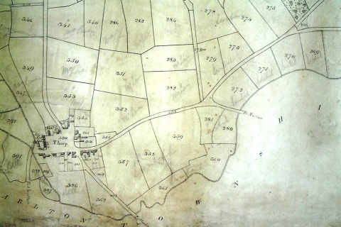
How it Once Was - Thorpe Thewles 1839
(Image courtesy of Durham Records Office)
The above is part of the tithe map for Grindon Parish of 1839. Tithe maps are important as the first systematic mapping survey of most of the land in England and Wales, as compared to estate maps which were for limited private use. They were made before the Ordnance Survey produced the large scale 25 inch to the mile series of maps.
In this section of map the village of Thorpe Thewles is clearly shown in the bottom right hand corner as are many familiar local roads with the obvious exception of the modern A177. Thorpe Beck is also shown as is the mill race which was still serving Thorpe Mill at this time. The flow from the mill fleam is shown to re-joins Thorpe Beck just short of the ford where Vicar's Bridge (at the head of the road to Carlton) now stands.
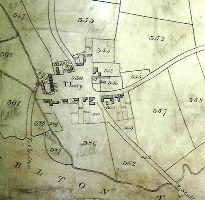
(Image courtesy of Durham Records Office)
The range of buildings that originally comprised Thorpe Thewles water mill plus the row of cottages above it (i.e. Mill Terrace or Fleetham's Cottages as it was then) are readily recognizable as are other houses and buildings which still stand today. These include cottages along Bank Terrace, Wynyard Road plus cottages adjacent to and the directly west of the Vane Arms. The buildings that constitute the present day Vane Arms, Hamilton Russell Arms plus Manor Farm are also obvious.
Not all of the buildings shown in the map of 1839 still survive today. Notable amongst these are those on the eastern side of the road from Sedgefield as it enters the village. Also the building at the east end of the present day Manor Cottages. This building was the village's first school house. A later school house (Grindon Church School) was erected slightly to the north of this site in 1899 and is now a private residence.
![]()